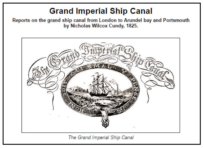
The Grand Imperial Ship Canal

Did you know there were plans drawn up to create a canal from London to Portsmouth that went through Epsom, Ashtead and Leatherhead? No I didn't either. The route would have taken the waterway across the fields what are now part of Ashtead Rye Meadows.
The following is an extract from the Epsom & Ewell History Explorer web site www.epsomandewellhistoryexplor... and was written by local historian Brian Bouchard whose property sits on or close to what would have been the route of the canal.
On page 25 in Epsom Common, a pamphlet published by The Epsom Common Association during 1981 it was written: -
"Before giving some account of those railways which affected our Common. reference must be made to a most attractive scheme which never came into being. It is too interesting and bizarre to omit. In 1825 rival plans were drawn up for the construction of a 'Grand Imperial Ship Canal' to link London with Portsmouth. Sailing round by sea could take up to twelve days, and it was estimated that the largest ships afloat' would use this canal and thus be able to make the journey in less than 24 hours. Fresh food and farm produce could be brought to London, bypassing the awful local roads, shipwrecks could be avoided, and, in time of war, should such arise, goods and equipment could be taken to the naval base at Portsmouth rapidly and without risk. George Rennie and his brother, John the Younger, submitted plans for this splendid project. Their prospectus detailed an 86 mile stretch of canal, 300 feet wide, 24 feet deep, from Deptford via Merton, Chessington, Epsom Common, Guildford, Alfold and Loxwood to the Arun valley, thence to Langstone Harbour: estimated cost £7 million. A rival set of proposals took the canal by a slightly different route on its southern reaches, but this too would have crossed Epsom Common entering it at a point most oddly described as 'The Gate on Epsom Common'. The whole thing however came to nothing and created little other than recrimination between the rival builders. One can't help regretting this. The vision of large ships placidly crossing our Common and passing all those bramble bushes, crab-apple trees, wild roses and furze patches is very attractive."
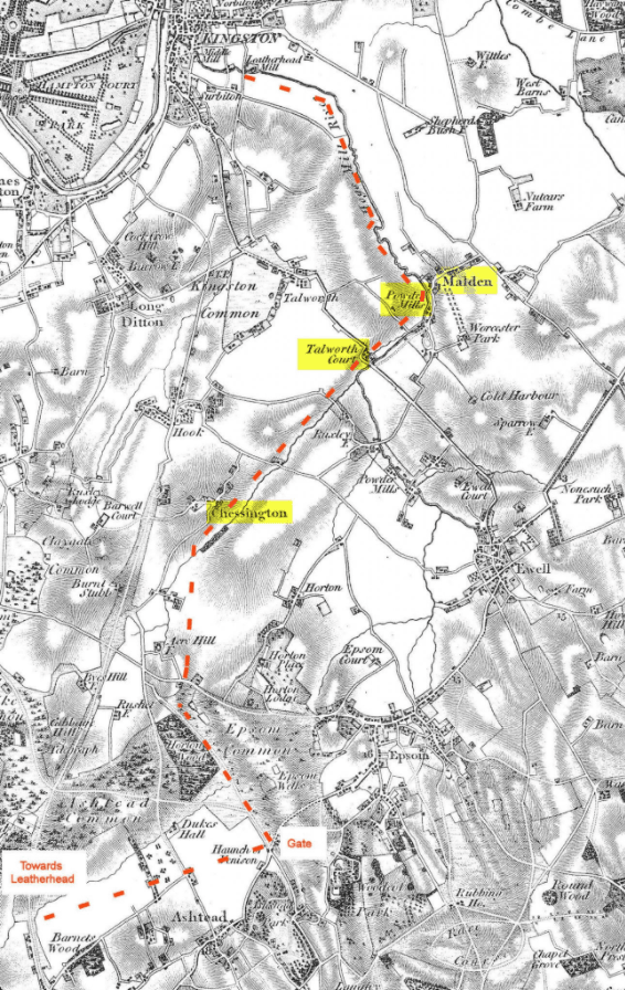
Mr Cundy, promoter of the scheme had described part of the route as "From Merton Road to Tolworth Court, across Merton Common and the Hogg Mill River, leaving Cannon Hill, Maiden Church, Mr. Taylor's Powder Mills, Worcester Park and Ewell to the left, the ground is remarkably level, and chiefly consists of meadow and arable land, without interfering with a single house or enclosure, through a clay soil with marl earth. From Tolworth Court over Horton Manor to Epsom Common, the land rises progressively to the summit valley on Epsom Common: (here millions of tons of the finest chalk can be brought to London, for brick-making, whitening, &c. at a small expense.) Between Tolworth Court and Epsom Common I recommend three locks to be placed, which will at once raise to and extend the summit level to twenty miles. From Epsom Common to Leatherhead Bridge, the line runs through Horton Wood, about two miles of open common and some meadow and arable land, and one or two small enclosures: the understrata consists of chalk, brick earth and clay soil. At Leatherhead Bridge the summit level will require filling and embanking for nearly a mile, which will give an opportunity of passing the Mole River under the bed of the Canal: here the line strikes through two enclosures up Mickleham Vale, passing the East side of Norbury Park to Dorking Mill Pond, without being obstructed."
To see the route map for the local area and to see where the proposal would have taken the canal through what is now Ashtead Rye Meadows go to http://www.epsomandewellhistoryexplorer.org.uk/Canal.html. Click the thumbnail of the map and it will enlarge.
His schedule of distances included "To the Gate on Epsom Common 7½ & From Epsom Gate over the Common to Leatherhead Bridge 3."
'Horton Wood' is a misnomer incorporated by Surveyors on to the Ordnance Survey map of 1816 and copied by later cartographers: it was actually Newton Wood in Ashtead Forest.
The projected route may be traced on the Surrey Ordnance Survey map surveyed around 1811 and published 1816-1819. It would have run beside the Hogs Mill River, passing St John the Baptist Parish Church, Old Malden, to Talworth (sic) Court, then along its tributary the Bonesgate Stream behind Ruxley Farm to reach Chessington. There it would need to rise up to the north-western corner of Epsom Common, near the present Old Glanmire Farm.
A southern descent through Ashtead's Newton Wood would have been started close to Woodcock Corner to parallel bridleway 38 down to Summersgate (at the western end of Woodlands Road, The Wells, Epsom) - 'The Gate on Epsom Common'. Thence the route continues west along The Rye brook through Ashtead Common and The Woodfield towards the River Mole at Leatherhead.
The ships were to be hauled along the canal by 'steam towage'.
Details of the various proposals for this ship canal which was never built may be found at www.jim-shead.com
